01 / Course preparation A6 / 105 × 148 mm
Yardage Book
All Tees / MetresBuild your plan from the tee. Study the hole, recognise key references and make room for your own observations.
Enquire about a Yardage Book Get in touch
For golfers serious about getting better.
More than a round. An opportunity to improve.
Prepare with purpose. Play with a plan.
The XYARD approach
Understand the course in front of you. Consider your options. Make a plan you can commit to.
XYARD brings course information into a clear, considered format you can carry, study and make your own. For the junior finding their game, and the golfer who never stops learning.
Learn the course.
Find your references.
See your options.
Choose with purpose.
Record what you notice.
Bring it to your next round.
Two tools. One purpose.
From tee to green, give your preparation
the attention it deserves.
Build your plan from the tee. Study the hole, recognise key references and make room for your own observations.
Enquire about a Yardage BookTake a closer look at the green. Explore the mapped shape, surrounding features and the terrain information available for your course.
Enquire about a Green BookCovers shown are brand application examples. Ask us about course availability, the current edition and included map content.
Inside the book
Clear references for preparation, and space to make the round your own. Take a look at the layouts.
All-tee length references, metre grids and distance rings to a fixed green reference. A continuous two-page layout with a simple Notes area.
Layout sample: Windross Farm, hole 1.
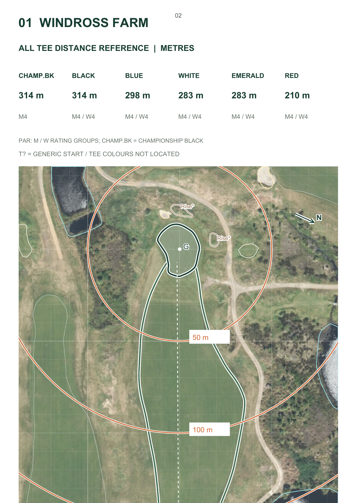
Examples show existing layouts from Windross Farm and Royal Wellington. Content and map types vary by course and edition. Official tee lengths do not verify coloured tee positions; T? denotes a generic mapped start. Modelled green terrain is a reference, not a putting-grade field survey or a recommended putting line. Check current conditions and any event restrictions.
Map data: © OpenStreetMap contributors, ODbL. Windross imagery: Auckland Council / Aerial Surveys. Terrain: RSHL / Woolpert / MFE / Auckland Council. Royal Wellington imagery and terrain: Upper Hutt City Council / Greater Wellington Regional Council / Aerial Surveys. Via Toitū Te Whenua LINZ, adapted, CC BY 4.0. Display renders retain the source layouts; no new survey is implied. Read source notes.
The next round starts here.
No matter your age or handicap, there is always something to learn.
Bring curiosity. Bring a plan. Make every round count.
Your course. Your next step.
Looking for a book for your next round? Exploring an idea for your course, pro shop or coaching programme? We'd like to hear from you.
legendxu@gmail.com Tell us your course and which book you're interested in.